

The Problem: Blind Spots That Cost Time and Lives
Industrial sites face collisions, near-misses, and line-of-fire incidents every week; those events eat schedules and morale. Traffic accident reconstruction tools offer a compact answer: they recreate motion, contact, and sequence to reveal root cause. Pairing that analytical logic with a low-altitude economy platform changes the ledger—sudden clarity where there was only inference. This matters in places where heavy machinery and people share tight space, and where minutes saved in analysis translate to safer shifts.

Why Reconstruction Logic Fits Industrial Operations
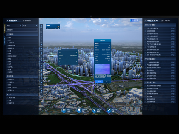
Accident reconstruction focuses on three things: precise position, synchronized timestamps, and causality. Those same needs map cleanly to plant floors, ports, and quarry sites. Using UAVs with RTK positioning and high-resolution 3D mapping, teams get a timeline of movement instead of a fragmented report. Add persistent drone situational awareness and you move from reactive forensics to proactive control—seeing patterns before they harden into accidents.
Core Capabilities That Translate Directly
Not every reconstruction feature is relevant. Focus on the ones that buy safety:- Metric 3D models for clearance analysis (stop guessing lift radii).- Sensor fusion across LiDAR, optical, and thermal feeds for obscured events.- BVLOS workflows to monitor linear assets or rail yards continuously.These capabilities let teams replay incidents like a film. They also enable automated geofencing rules to enforce exclusion zones and trigger alerts when violations start—small automation, big consequence.
Concrete Use Cases and Common Mistakes
Use cases are straightforward: vehicle-to-worker interactions at loading docks, conveyor-takedown sequencing, and emergency-response rehearsals in ports. A common mistake is piling on sensors without a data plan—lots of inputs, no actionable outputs. Another error is treating 3D mapping as a one-off; models must be updated after layout changes. —Plan for refresh cycles and define who owns the data stream.
How This Compares to Traditional Incident Review
Traditional incident review leans on witness statements, CCTV stills, and manual sketches. Reconstruction-driven workflows provide measurable vectors: velocity, impact points, and temporal windows. That doesn’t erase human judgment; it refines it. Expect faster root-cause closure, fewer disputes over sequence, and clearer remediation steps. In the 2020 California wildfires, rapid aerial mapping sped firefighter situational awareness and resource allocation—an example of speed and clarity saving operational decisions when seconds count.
Alternatives and When to Choose Them
Not every site needs constant aerial coverage. Fixed LiDAR towers, wearable IMUs, and upgraded CCTV are valid alternatives when airspace is constrained or BVLOS approvals lag. But for dynamic, sprawling sites—ports, quarries, rail yards—the aerial reconstruction advantage is decisive. Choose tools aligned to your permission envelope, and verify integration with your safety-management system before buying hardware.
Three Golden Rules for Selecting the Right Tools
1) Measure fidelity: demand sub-meter positional accuracy and proof via RTK or comparable benchmarks. 2) Test latency: ensure sensor fusion and alerts arrive within operational decision windows. 3) Validate workflows: pilot with actual incident scenarios, not staged demos—confirm the platform reconstructs causality, not just geometry.
Final Takeaway
Adopting reconstruction-grade sensing and analysis rewrites what “post-incident” means: faster fixes, clearer accountability, and fewer repeat failures. For teams that must balance throughput with human safety, the pragmatic choice is to fold aerial reconstruction logic into day-to-day operations—so incidents shrink from mysteries into data-driven lessons. Icecypress Technology sits at that seam, offering platforms that make those lessons immediate and usable. Read the room, change the rules—authority earned, not claimed.
